
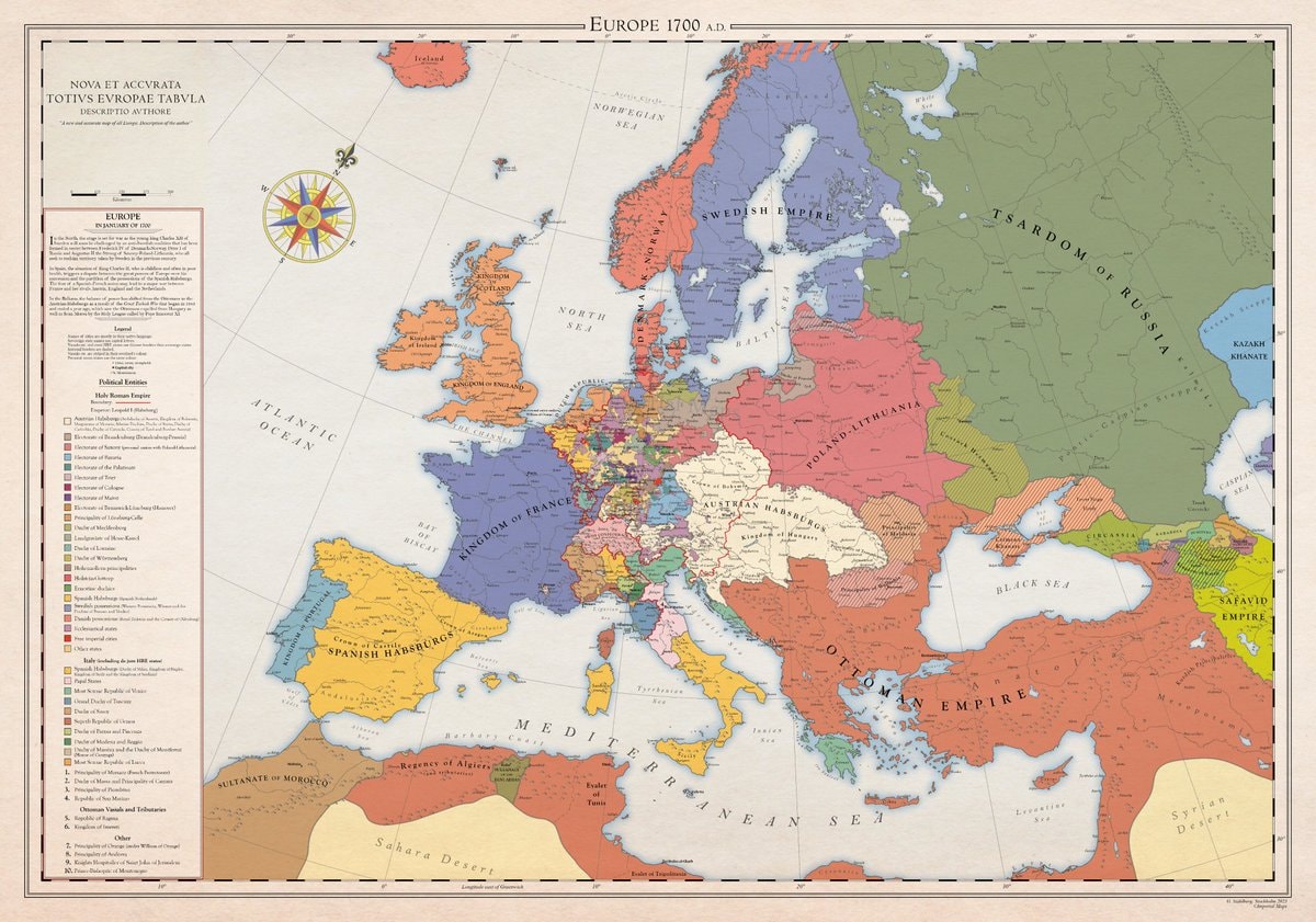
@scarlett_sA whole different map back then, Europe was something else in 1700
Originalbeitrag ansehen@scarlett_sA whole different map back then, Europe was something else in 1700
Originalbeitrag ansehenFoto von @scarlett_s· Aug 30, 2026· News
The image is a historical map of Europe in 1700 AD. It displays political boundaries and territories with various colors representing different empires and kingdoms. The map has a vintage aesthetic with a compass rose and a detailed legend. A notable detail is the extensive coloring of the Holy Roman Empire into many smaller states. ON-SCREEN TEXT: EUROPE 1700 A.D. NOVA ET ACCVRATA TOTIVS EVROPAE TABVLA DESCRIPTIO AVTHORE "A new and accurate map of all Europe. Description of the author." Legend Political Entities Holy Roman Empire Boundary Additional (Habsburgs, Electors, etc.) Electorate of Bavaria Electorate of Cologne Electorate of Mainz Electorate of Trier Electorate of Saxony Electorate of Brandenburg Electorate of the Palatinate Duchy of Bavaria Duchy of Saxe-Lauenburg (Saxony) Duchy of Saxe-Gotha Duchy of Saxe-Meiningen Duchy of Saxe-Weimar Principality of Ansbach Princip
 $61 million crypto seizure from Iranian oil
 anime character in Crunchyroll shirt
 North West reaction to Kai Cenat Gigi reunion
 Martha Stewart nudes decision
 Dmitry Medvedev on AI honesty
 Cartrack customer data breach confirmed
 3US Strategic Petroleum Reserve lowest since 1982
 Ella Langley Tate McRae new photo
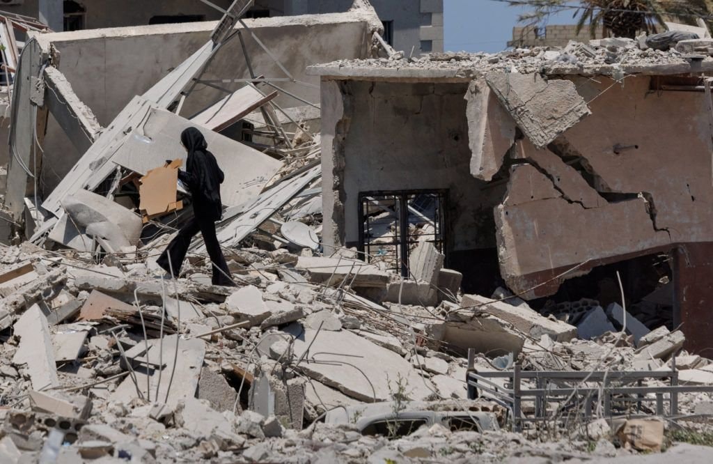 3Lebanon displacement data September 9
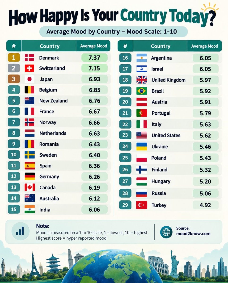 Countries ranked by average mood score
 Kojima Productions Xbox partnership
 Trump on Iran and diesel
 Xbox CEO Asha Sharma
 I'm single and searching 😔
@scarlett_sA whole different map back then, Europe was something else in 1700
Originalbeitrag ansehenFoto von @scarlett_s· Aug 30, 2026· News
The image is a historical map of Europe in 1700 AD. It displays political boundaries and territories with various colors representing different empires and kingdoms. The map has a vintage aesthetic with a compass rose and a detailed legend. A notable detail is the extensive coloring of the Holy Roman Empire into many smaller states. ON-SCREEN TEXT: EUROPE 1700 A.D. NOVA ET ACCVRATA TOTIVS EVROPAE TABVLA DESCRIPTIO AVTHORE "A new and accurate map of all Europe. Description of the author." Legend Political Entities Holy Roman Empire Boundary Additional (Habsburgs, Electors, etc.) Electorate of Bavaria Electorate of Cologne Electorate of Mainz Electorate of Trier Electorate of Saxony Electorate of Brandenburg Electorate of the Palatinate Duchy of Bavaria Duchy of Saxe-Lauenburg (Saxony) Duchy of Saxe-Gotha Duchy of Saxe-Meiningen Duchy of Saxe-Weimar Principality of Ansbach Princip
$61 million crypto seizure from Iranian oilanime character in Crunchyroll shirtNorth West reaction to Kai Cenat Gigi reunionMartha Stewart nudes decisionDmitry Medvedev on AI honestyCartrack customer data breach confirmed3US Strategic Petroleum Reserve lowest since 1982Ella Langley Tate McRae new photo3Lebanon displacement data September 9Countries ranked by average mood scoreKojima Productions Xbox partnershipTrump on Iran and dieselXbox CEO Asha SharmaI'm single and searching 😔