
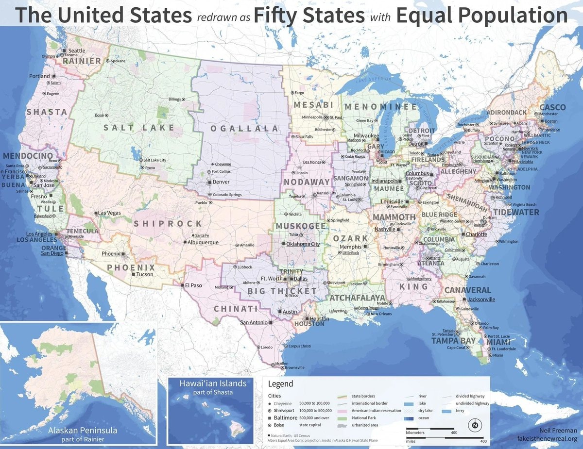
@taikiA hypothetical map showing the United States with fifty states of equal population
Originalbeitrag ansehen@taikiA hypothetical map showing the United States with fifty states of equal population
Originalbeitrag ansehenFoto von @taiki· Aug 30, 2026· United States
The image is a map of the United States. The map is stylized to show the country redrawn into fifty states of equal population. The map includes labels for new state names like "Rainier," "Shasta," "Mendocino," "Tule," "Temecula," "Orange," "Phoenix," "Shiprock," "Big Thicket," "Chinati," "Atchafalaya," "King," "Canaveral," "Tampa Bay," "Miami," "Tidewater," "Shenandoah," "Allegheny," "Blue Ridge," "Columbia," "Mammoth," "Blue Ridge," "Ozark," "Muskogee," "Nodaway," "Sangamon," "Maumee," "Detroit," "Firelands," "Gary," "Mesabi," "Menominee," "Ogallala," and "Adirondack." There are also inset maps showing the Hawaiian Islands and the Alaskan Peninsula. A legend explains the map's symbols and colors. The title at the top reads "The United States redrawn as Fifty
 Hungary county map with coats of arms
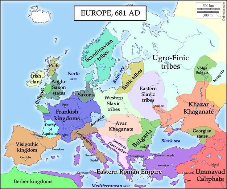 Europe in 681
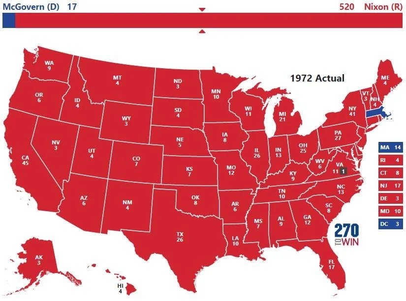 1972 US presidential election map
 Second most spoken language in Mexico
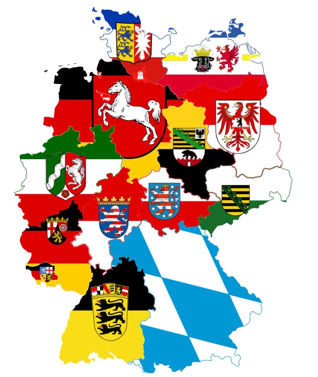 germany sixteen states
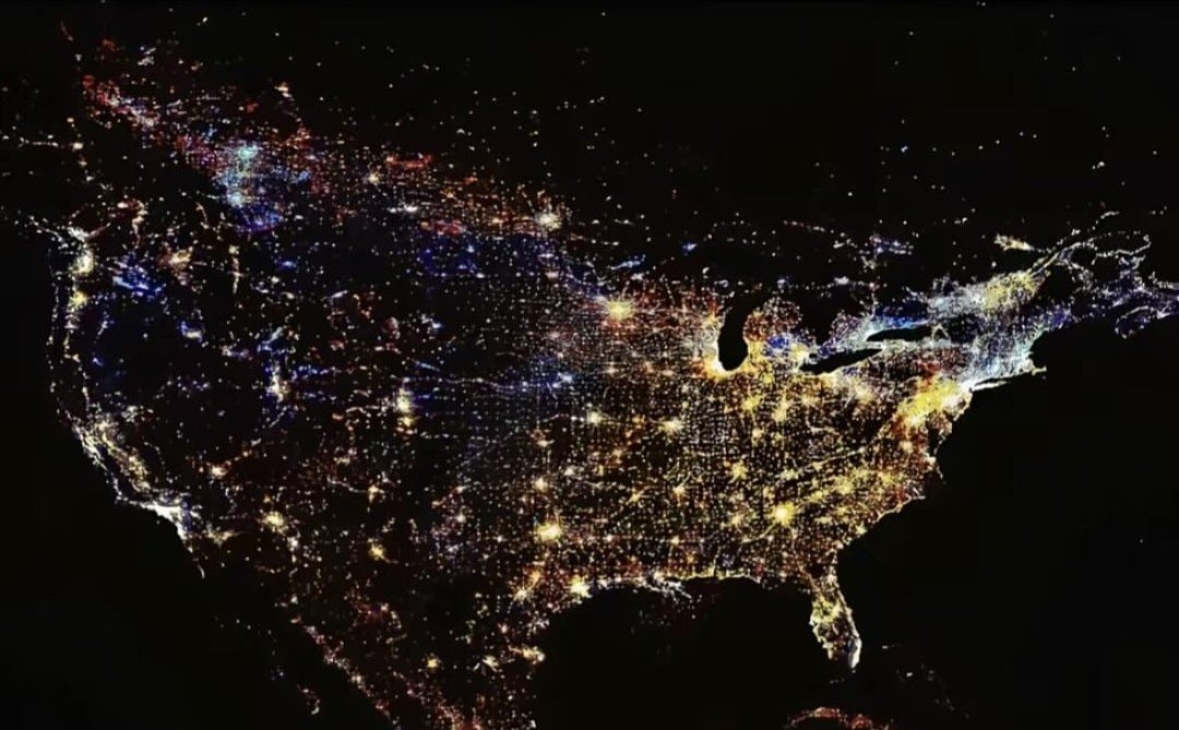 United States at night
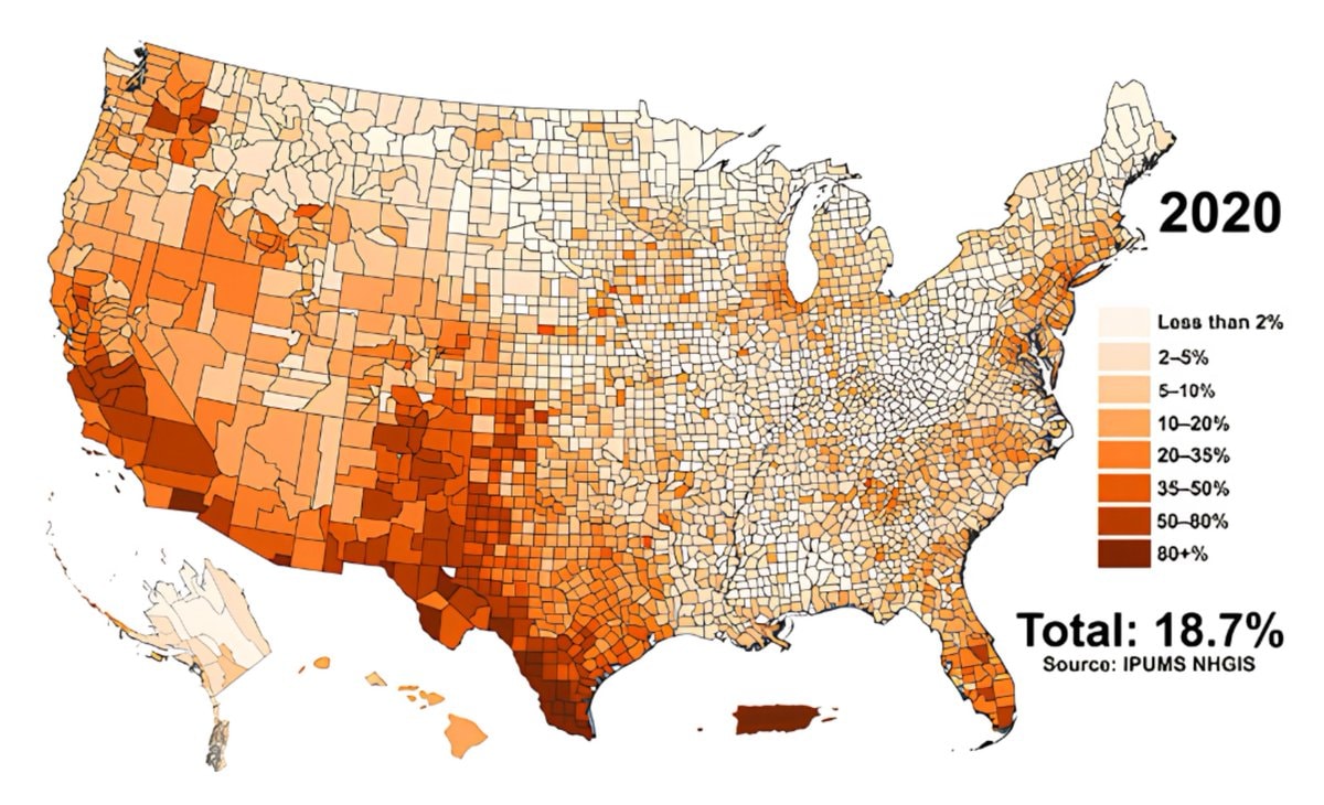 Hispanic population share by U.S. county
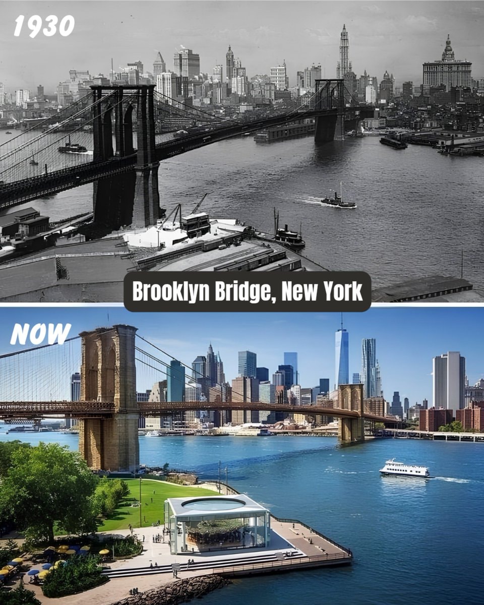 Brooklyn Bridge New York 1930 vs Now
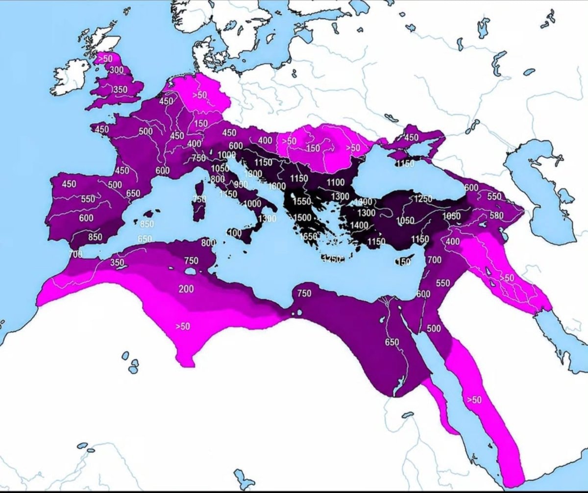 Roman Empire years of control by region
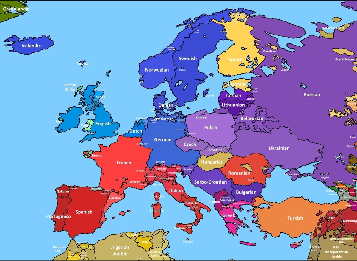 European language map by spoken usage
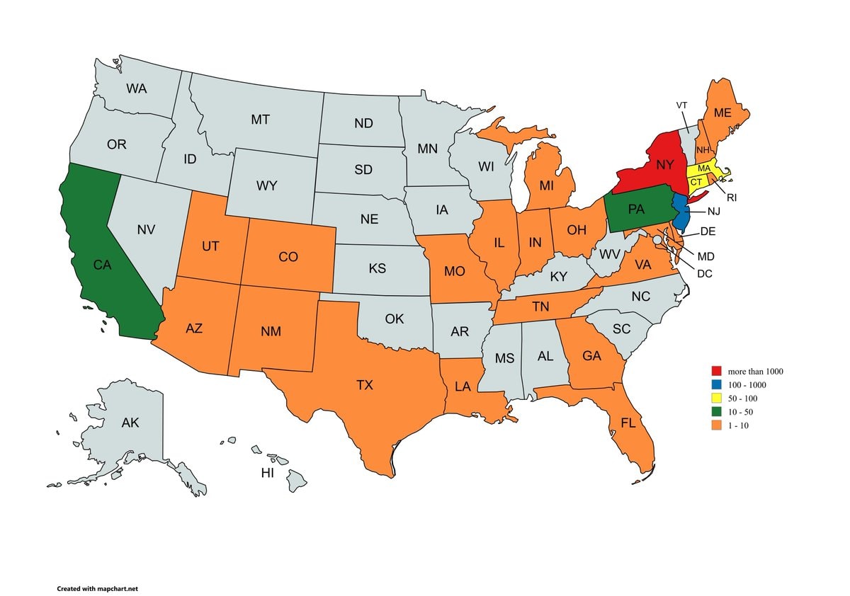 9/11 victims by home state
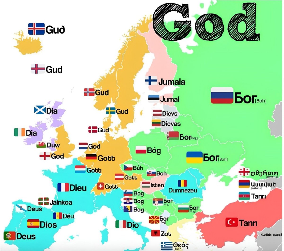 God translations by European region
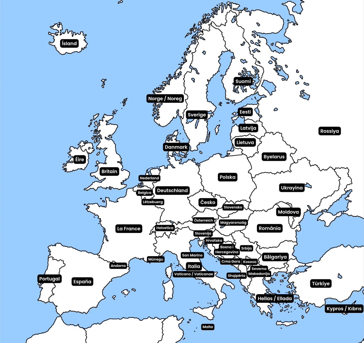 European country native names
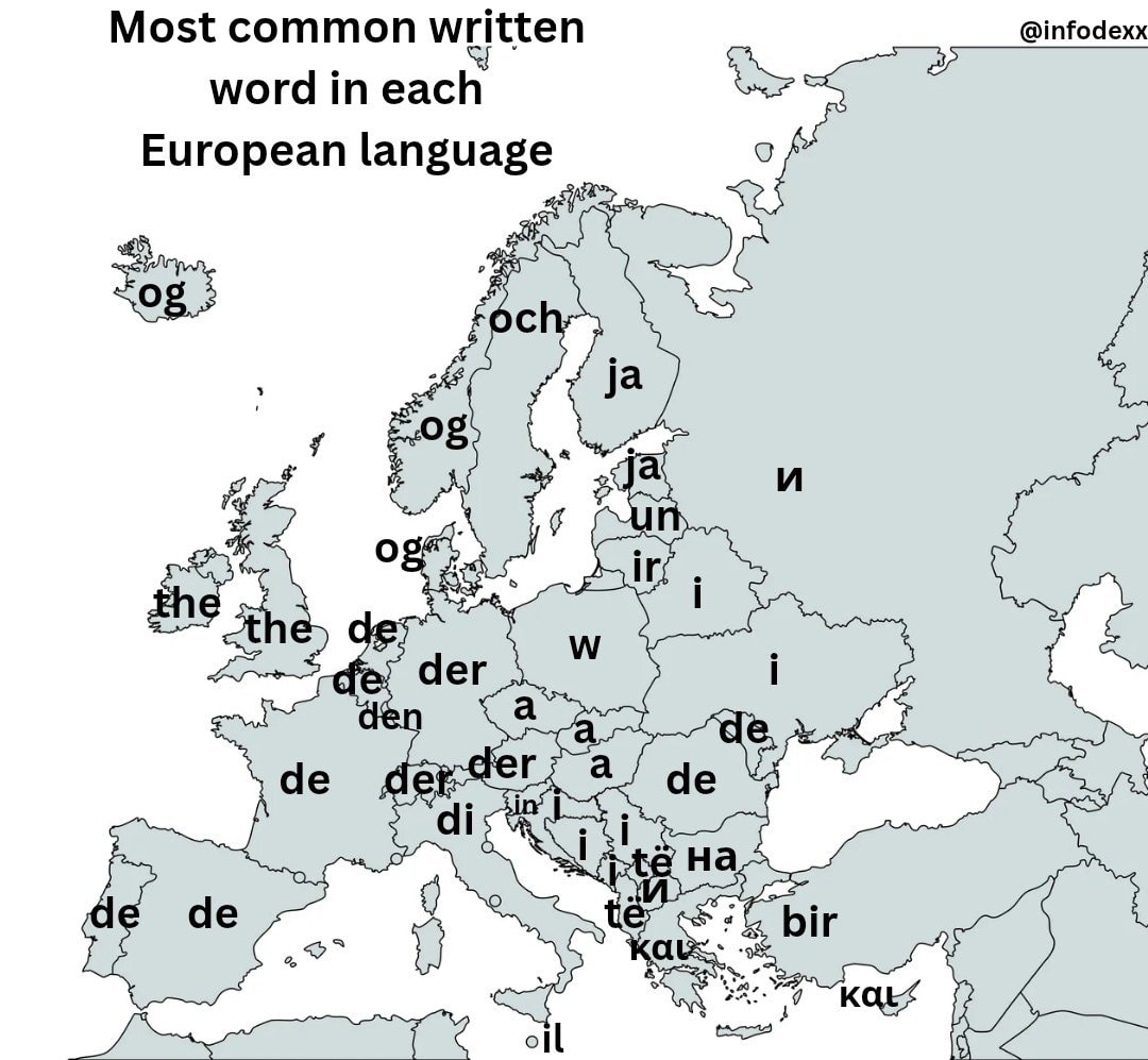 most common written word by european language
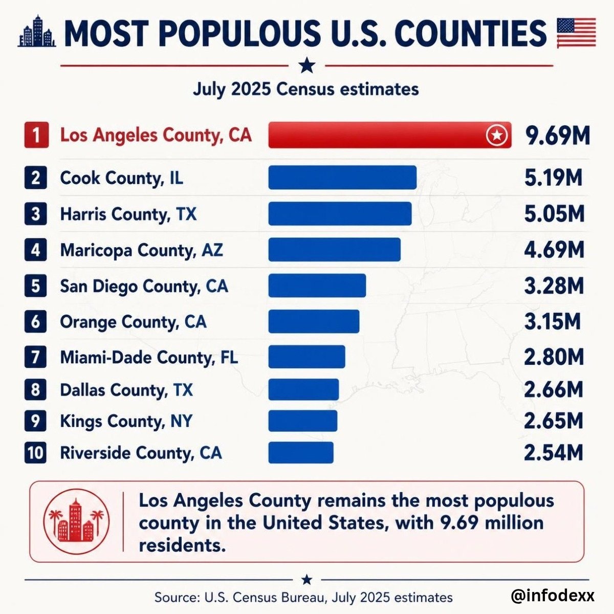 Most populous U.S. Counties
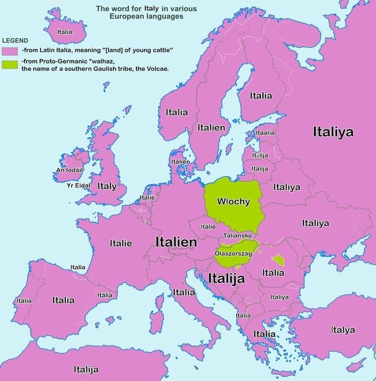 Map of how Europe says Italy
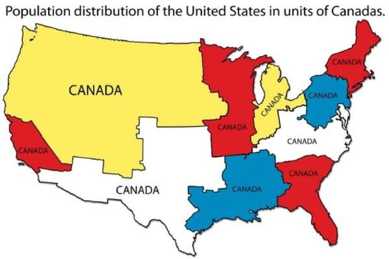 U.S. Population Units of Canada
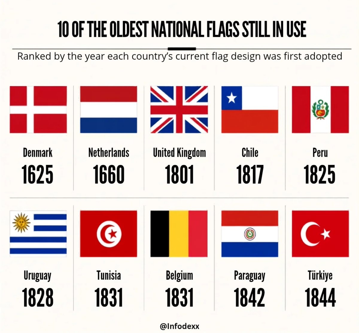 oldest national flags in use
@taikiA hypothetical map showing the United States with fifty states of equal population
Originalbeitrag ansehenFoto von @taiki· Aug 30, 2026· United States
The image is a map of the United States. The map is stylized to show the country redrawn into fifty states of equal population. The map includes labels for new state names like "Rainier," "Shasta," "Mendocino," "Tule," "Temecula," "Orange," "Phoenix," "Shiprock," "Big Thicket," "Chinati," "Atchafalaya," "King," "Canaveral," "Tampa Bay," "Miami," "Tidewater," "Shenandoah," "Allegheny," "Blue Ridge," "Columbia," "Mammoth," "Blue Ridge," "Ozark," "Muskogee," "Nodaway," "Sangamon," "Maumee," "Detroit," "Firelands," "Gary," "Mesabi," "Menominee," "Ogallala," and "Adirondack." There are also inset maps showing the Hawaiian Islands and the Alaskan Peninsula. A legend explains the map's symbols and colors. The title at the top reads "The United States redrawn as Fifty
Noch keine Kommentare. Sei der Erste!
Hungary county map with coats of armsEurope in 6811972 US presidential election mapSecond most spoken language in Mexicogermany sixteen statesUnited States at nightHispanic population share by U.S. countyBrooklyn Bridge New York 1930 vs NowRoman Empire years of control by regionEuropean language map by spoken usage9/11 victims by home stateGod translations by European regionEuropean country native namesmost common written word by european languageMost populous U.S. CountiesMap of how Europe says ItalyU.S. Population Units of Canadaoldest national flags in use
Noch keine Kommentare. Sei der Erste!