
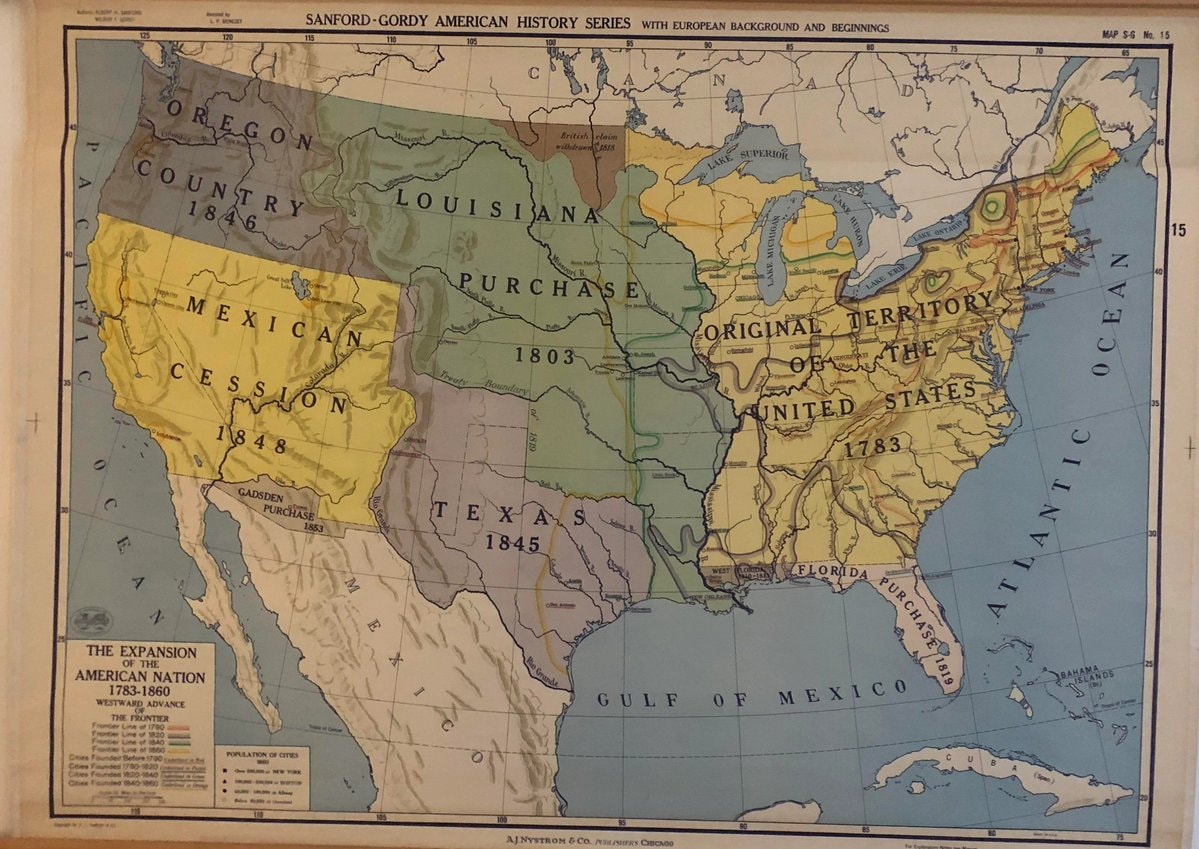
@scarlett_sA long read on how the United States expanded between 1783, 1860
Originalbeitrag ansehen@scarlett_sA long read on how the United States expanded between 1783, 1860
Originalbeitrag ansehenFoto von @scarlett_s· Sep 24, 2026· United States
The image is a historical map of the United States. It depicts territorial expansion with different colored regions labeled with purchases and annexations like the Louisiana Purchase, Mexican Cession, and Texas 1845. The map has a vintage educational style. Notable details include the various dates associated with each territorial acquisition and the detailed labeling of geographical features and boundaries. ON-SCREEN TEXT: SANFORD-GORDY AMERICAN HISTORY SERIES WITH EUROPEAN BACKGROUND AND BEGINNINGS MAP S-G No. 15 THE EXPANSION OF THE AMERICAN NATION 1783-1860 WESTWARD ADVANCE THE FRONTIER Frontier Line of 1790 Frontier Line of 1820 Frontier Line of 1850 Frontier Line of 1860 Cities Founded Before 1790 Cities Founded 1790-1840 Cities Founded 1840-1860 POPULATION OF CITIES 1860 OVER 100,000 NEW YORK 50,0
 2Elon Musk $446 million midterm donations
 Debate skips environment and AI topics
 Hawaii beach
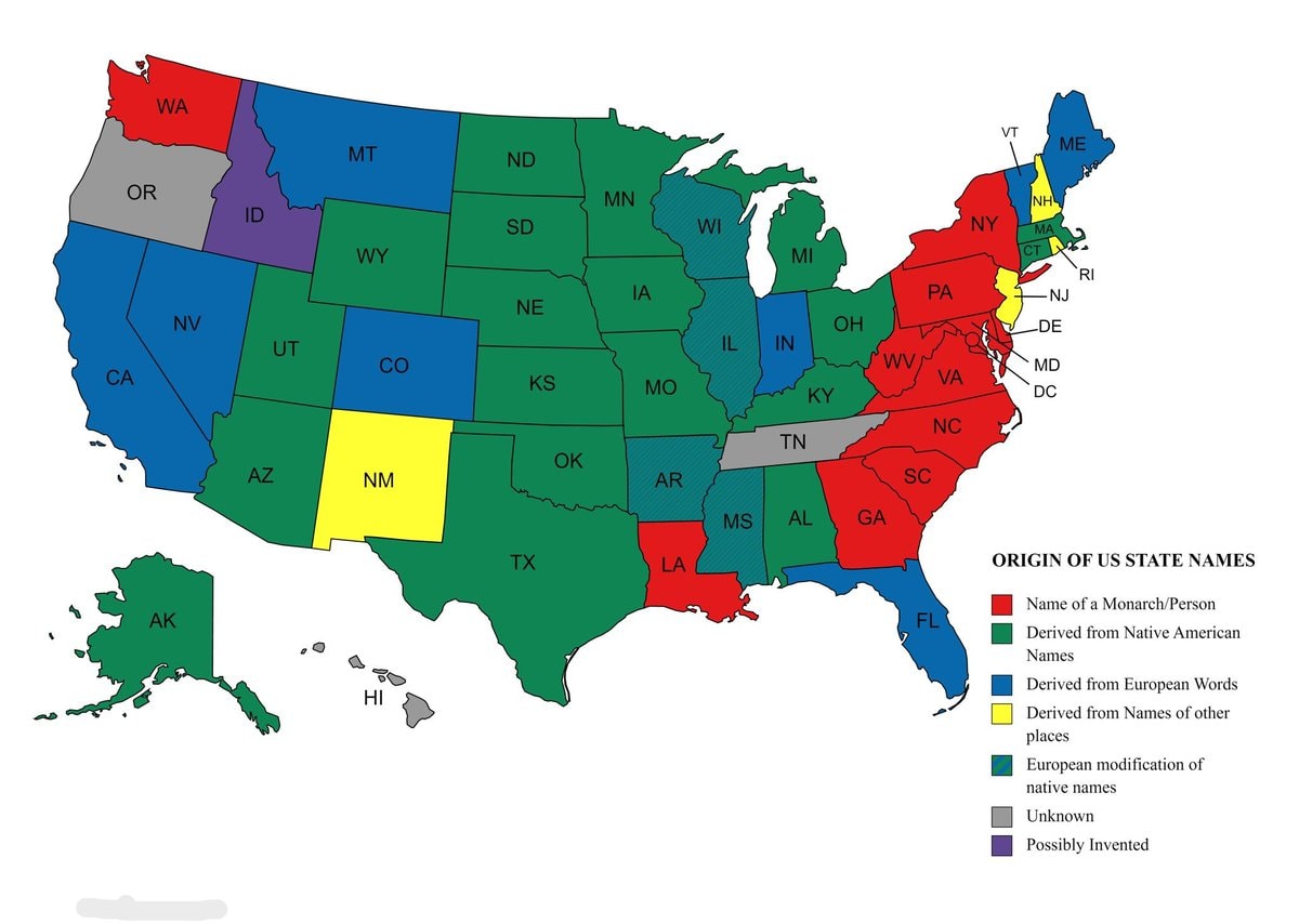 Origins of US state names map
 Experts urge vaccination as mutated virus surges
 WWE Crown Jewel Riyadh 11/7
 2Chiricahua National Monument becomes 64th national park
 Louise Lucas arrested charges
 US stock market open loss
 Unit 9900 Israel Saudi Arabia Yemen Intel
 US Lockheed Martin F-35 deal
 2Global central bank gold accumulation
 2Drake 2026 Spotify forecast
 2US Supreme Court ruling on federal prisons
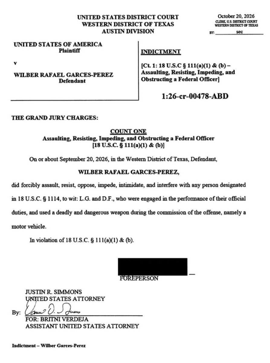 Wilber Rafael Garces Perez federal indictment
 2US greenhouse emissions rise
 2Marco Rubio statement on India
 Europe vs US China automation AI
@scarlett_sA long read on how the United States expanded between 1783, 1860
Originalbeitrag ansehenFoto von @scarlett_s· Sep 24, 2026· United States
The image is a historical map of the United States. It depicts territorial expansion with different colored regions labeled with purchases and annexations like the Louisiana Purchase, Mexican Cession, and Texas 1845. The map has a vintage educational style. Notable details include the various dates associated with each territorial acquisition and the detailed labeling of geographical features and boundaries. ON-SCREEN TEXT: SANFORD-GORDY AMERICAN HISTORY SERIES WITH EUROPEAN BACKGROUND AND BEGINNINGS MAP S-G No. 15 THE EXPANSION OF THE AMERICAN NATION 1783-1860 WESTWARD ADVANCE THE FRONTIER Frontier Line of 1790 Frontier Line of 1820 Frontier Line of 1850 Frontier Line of 1860 Cities Founded Before 1790 Cities Founded 1790-1840 Cities Founded 1840-1860 POPULATION OF CITIES 1860 OVER 100,000 NEW YORK 50,0
Noch keine Kommentare. Sei der Erste!
2Elon Musk $446 million midterm donationsDebate skips environment and AI topicsHawaii beachOrigins of US state names mapExperts urge vaccination as mutated virus surgesWWE Crown Jewel Riyadh 11/72Chiricahua National Monument becomes 64th national parkLouise Lucas arrested chargesUS stock market open lossUnit 9900 Israel Saudi Arabia Yemen IntelUS Lockheed Martin F-35 deal2Global central bank gold accumulation2Drake 2026 Spotify forecast2US Supreme Court ruling on federal prisonsWilber Rafael Garces Perez federal indictment2US greenhouse emissions rise2Marco Rubio statement on IndiaEurope vs US China automation AI
Noch keine Kommentare. Sei der Erste!