
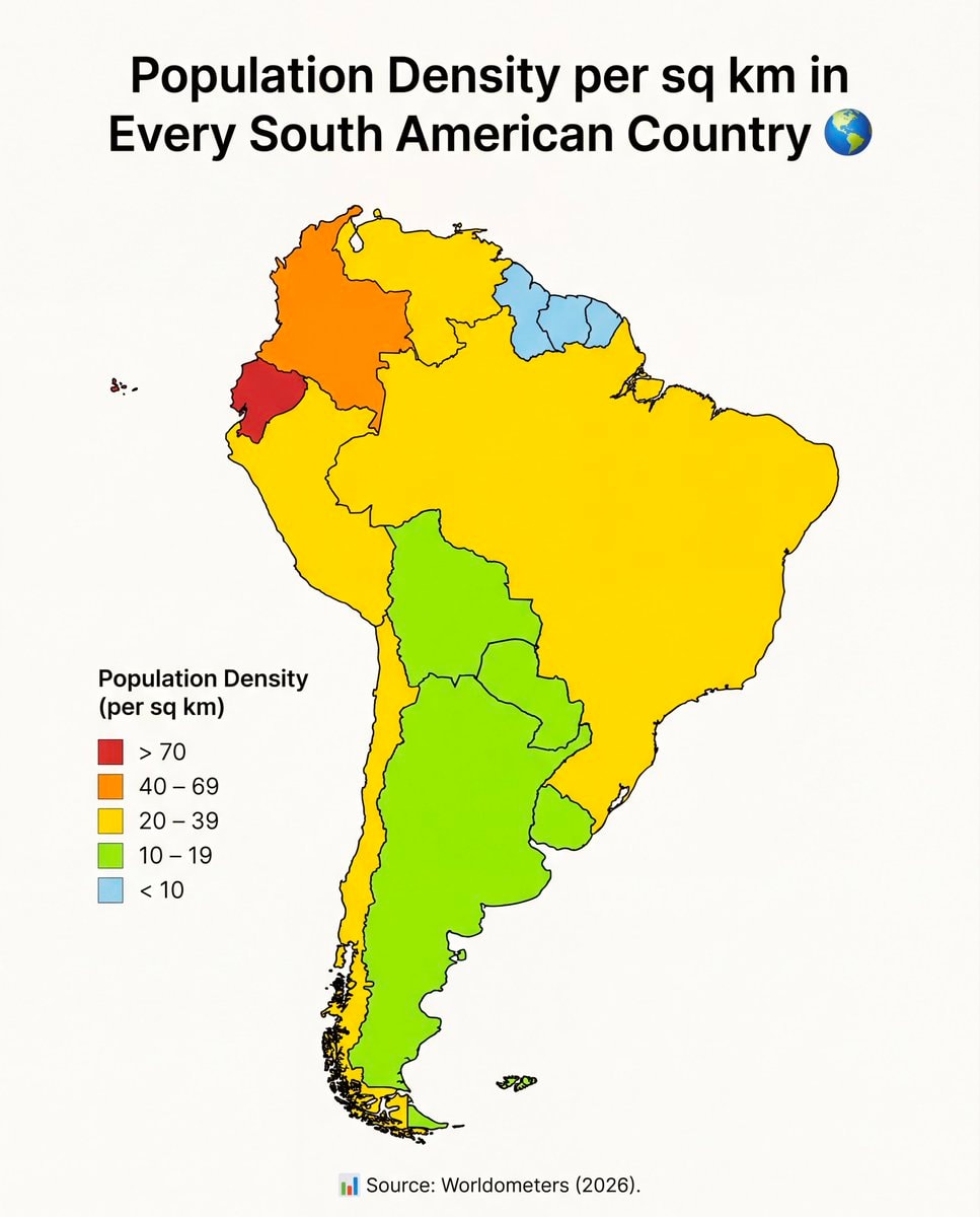
@savageupdatesActually this board breaks down population density per sq km in every South American nation.
Originalbeitrag ansehen@savageupdatesActually this board breaks down population density per sq km in every South American nation.
Originalbeitrag ansehenFoto von @savageupdates· Oct 27, 2026· Info/Editorials
The image is a map of South America color-coded to show population density per square kilometer. A legend on the left explains the color scale, ranging from red for >70 people per sq km to light blue for <10. The map's style is informative and data-driven, with a clean, graphic aesthetic. The title "Population Density per sq km in Every South American Country" is prominently displayed at the top, accompanied by a globe emoji. The source "Source: Worldometers (2026)" is visible at the bottom.
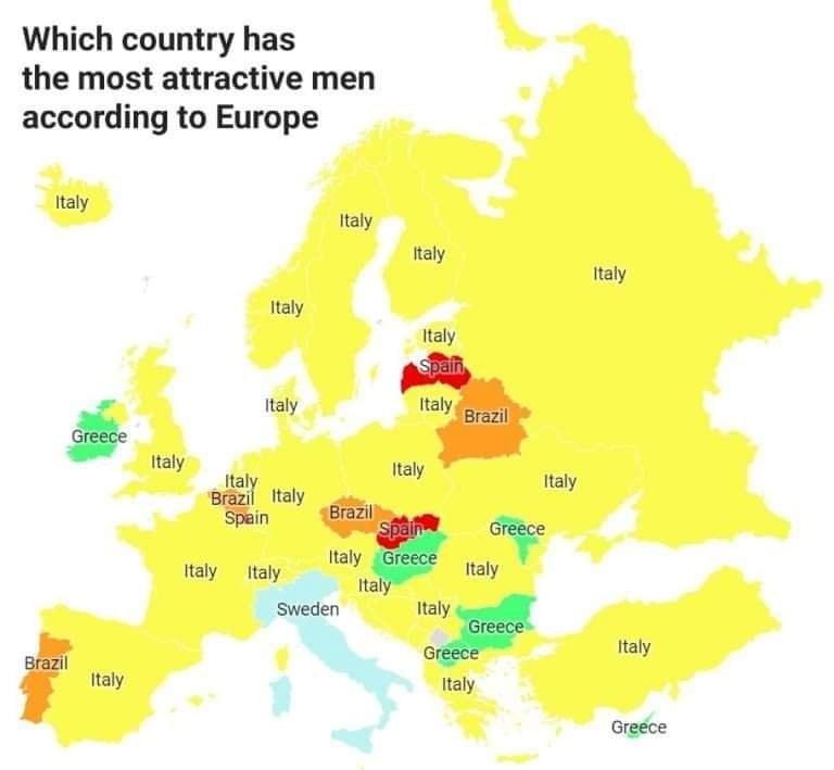 European countries map
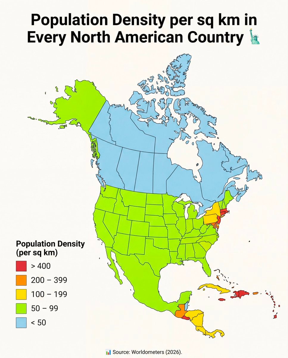 North America population density map
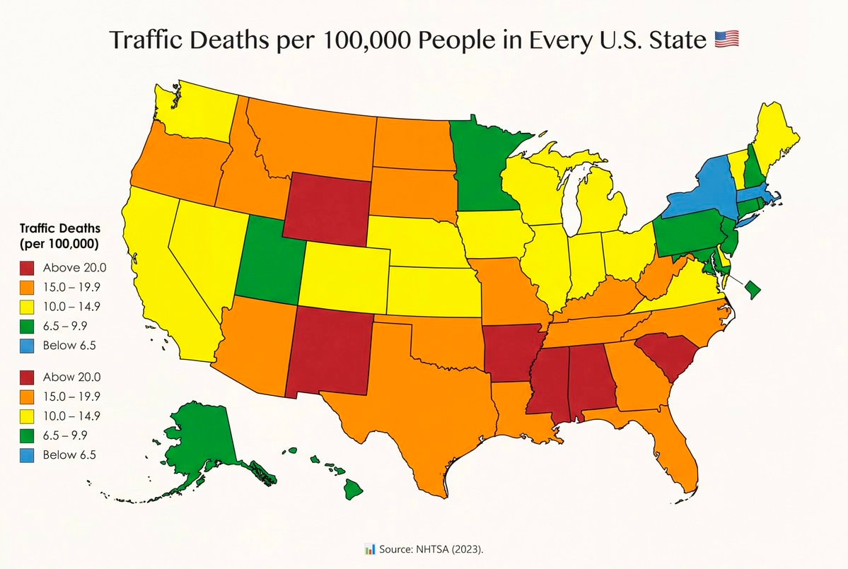 Traffic fatality rates by U.S. State
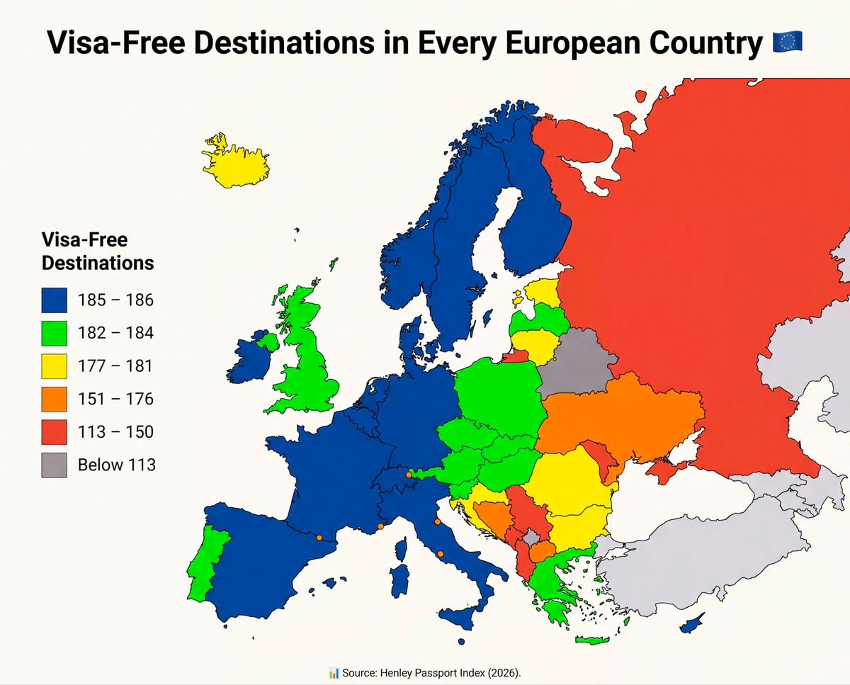 Visa-Free Destinations in Every European Country
 2Ballon d'Or Winners Since 1956
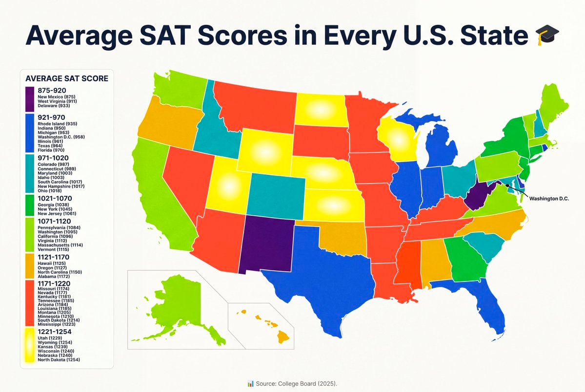 average SAT scores by U.S. State
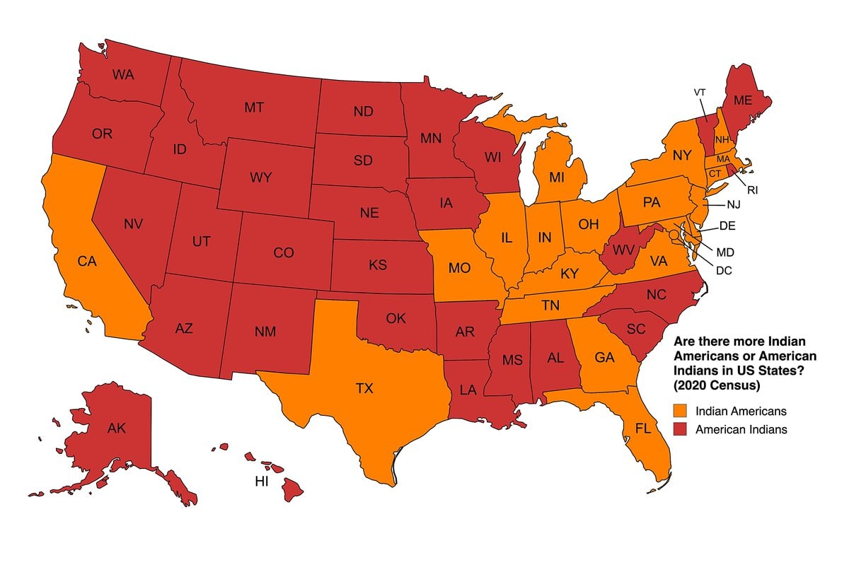 Indian Americans vs American Indians by US state
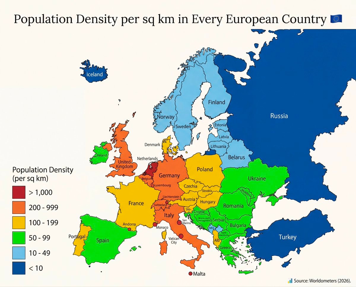 European population density map
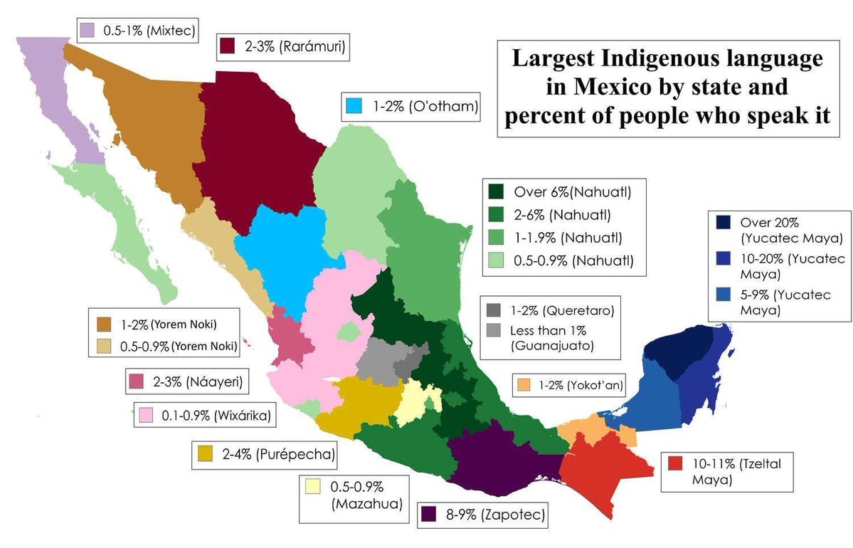 Largest Indigenous language by Mexican state
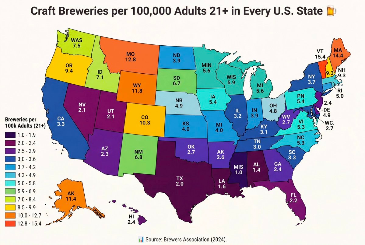 Craft breweries per 100,000 adults by state
 2Serial killers by country WorldAtlas ranking
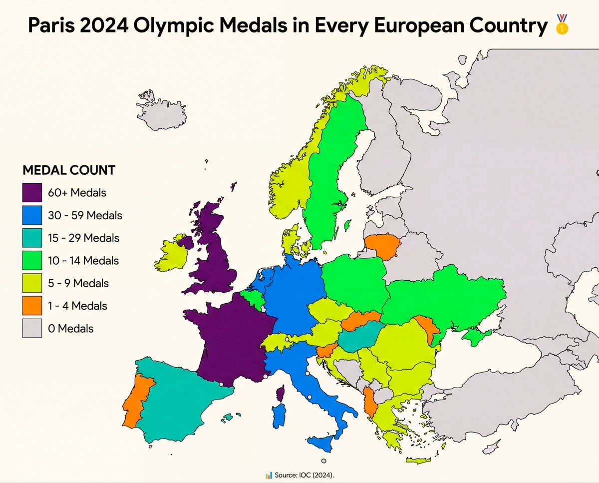 Paris 2024 Olympic medals by European country
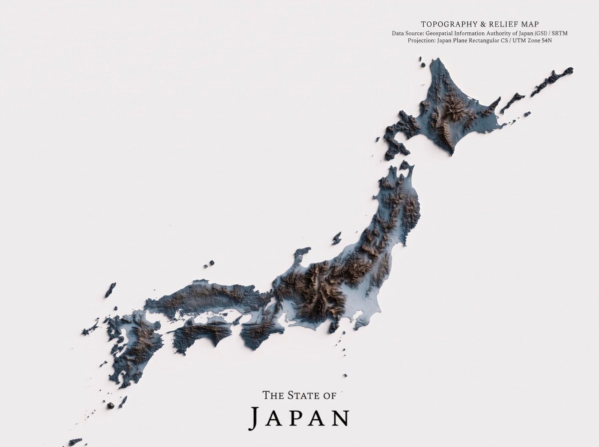 Japan topography map
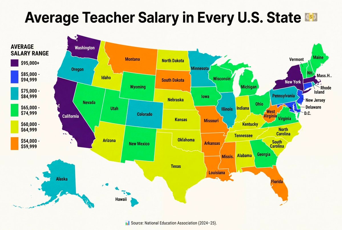 Average teacher salary by US state
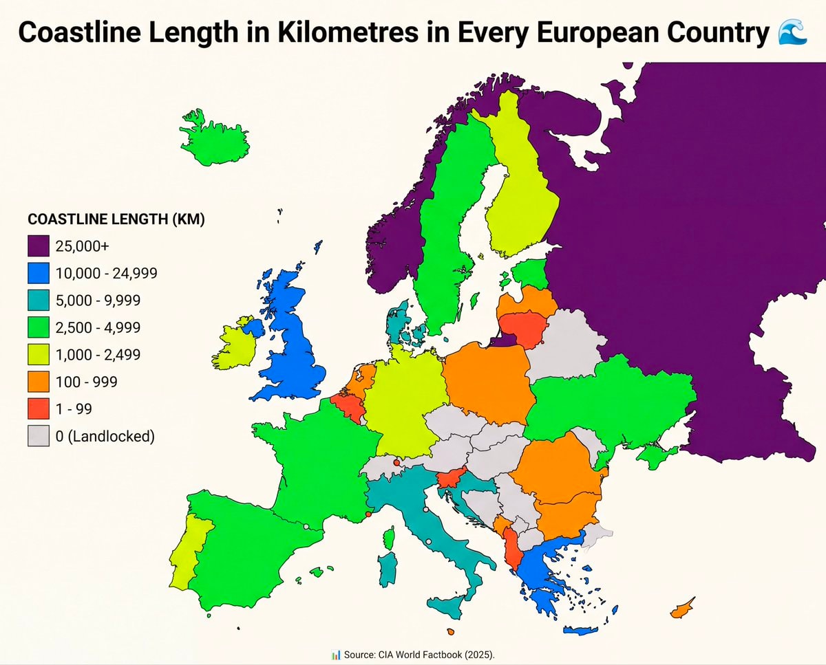 European coastline lengths by country
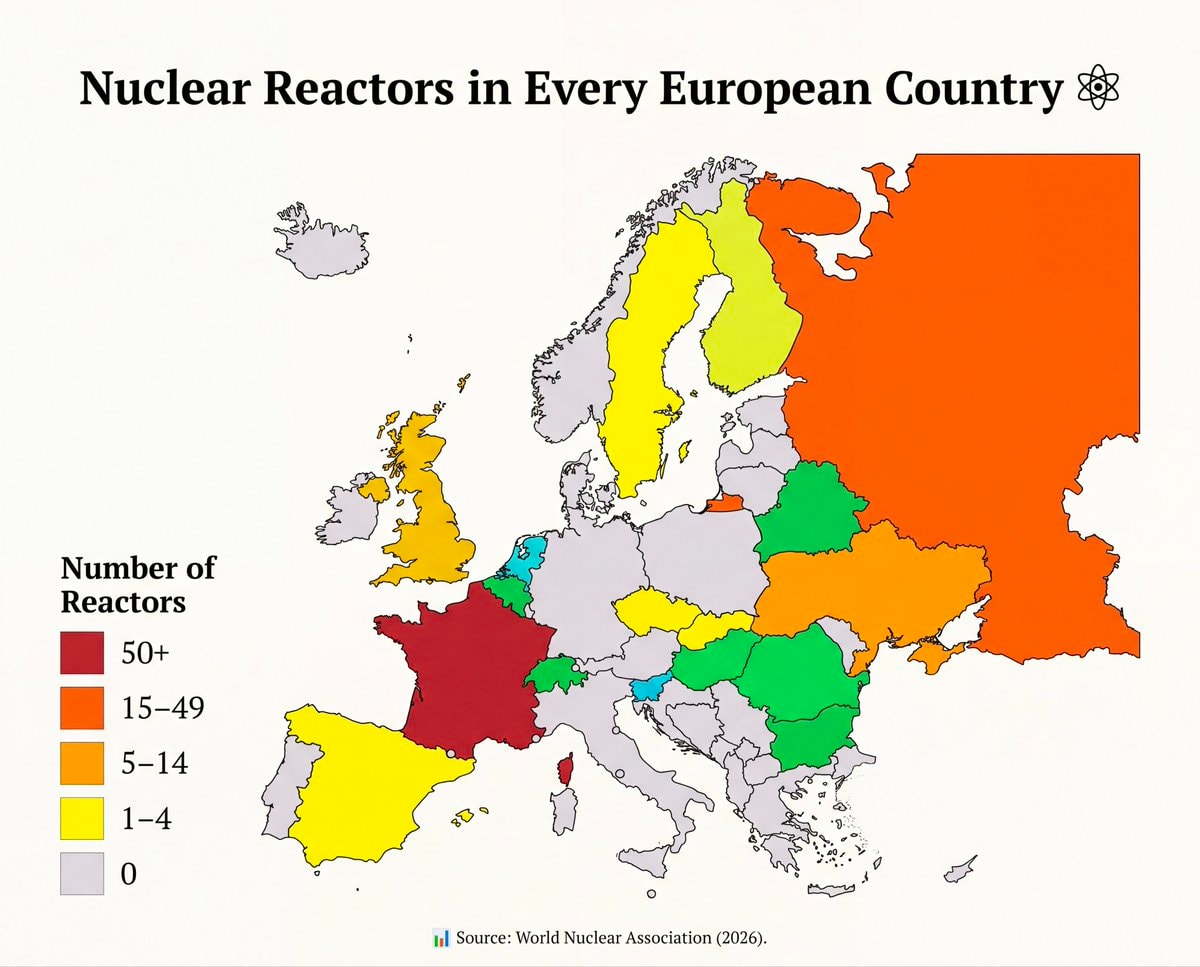 Nuclear reactors in every European country
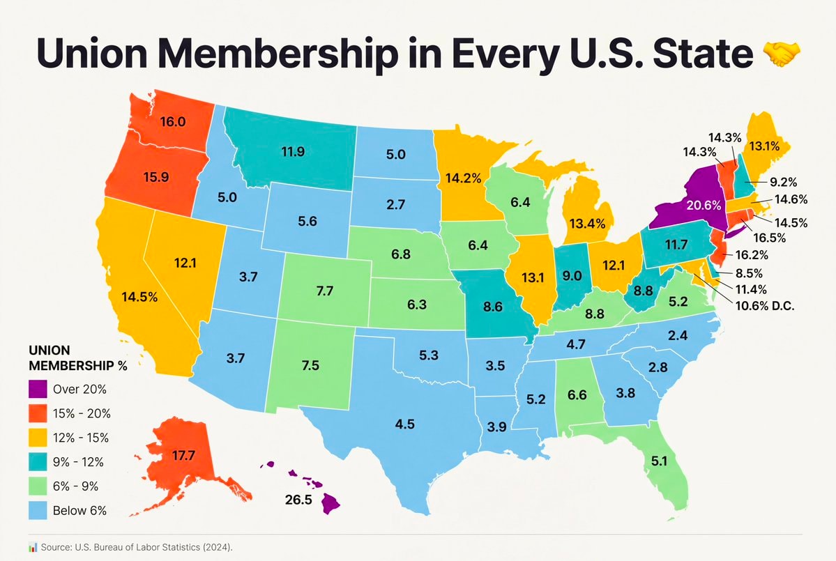 Union Membership by U.S. State
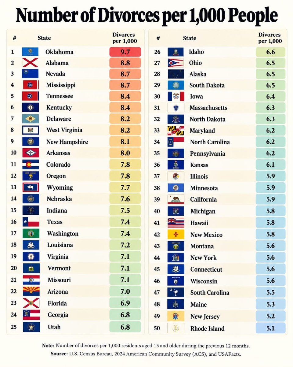 US divorce rates by state
@savageupdatesActually this board breaks down population density per sq km in every South American nation.
Originalbeitrag ansehenFoto von @savageupdates· Oct 27, 2026· Info/Editorials
The image is a map of South America color-coded to show population density per square kilometer. A legend on the left explains the color scale, ranging from red for >70 people per sq km to light blue for <10. The map's style is informative and data-driven, with a clean, graphic aesthetic. The title "Population Density per sq km in Every South American Country" is prominently displayed at the top, accompanied by a globe emoji. The source "Source: Worldometers (2026)" is visible at the bottom.
Noch keine Kommentare. Sei der Erste!
European countries mapNorth America population density mapTraffic fatality rates by U.S. StateVisa-Free Destinations in Every European Country2Ballon d'Or Winners Since 1956average SAT scores by U.S. StateIndian Americans vs American Indians by US stateEuropean population density mapLargest Indigenous language by Mexican stateCraft breweries per 100,000 adults by state2Serial killers by country WorldAtlas rankingParis 2024 Olympic medals by European countryJapan topography mapAverage teacher salary by US stateEuropean coastline lengths by countryNuclear reactors in every European countryUnion Membership by U.S. StateUS divorce rates by state
Noch keine Kommentare. Sei der Erste!