
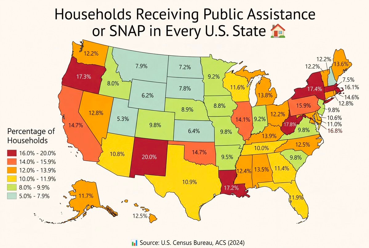
@savageupdatesActually every single U.S. state has households on public assistance or SNAP.
Originalbeitrag ansehen@savageupdatesActually every single U.S. state has households on public assistance or SNAP.
Originalbeitrag ansehenFoto von @savageupdates· Oct 29, 2026· United States
The image is a map of the United States showing the percentage of households receiving public assistance or SNAP in every state. The states are color-coded according to a legend that indicates percentage ranges from 5.0% - 7.9% to 16.0% - 20.0%. The mood is informative and data-driven. A small house icon is placed next to the title. The source is listed as U.S. Census Bureau, ACS (2024).
 Natural gas price gap: US vs Europe
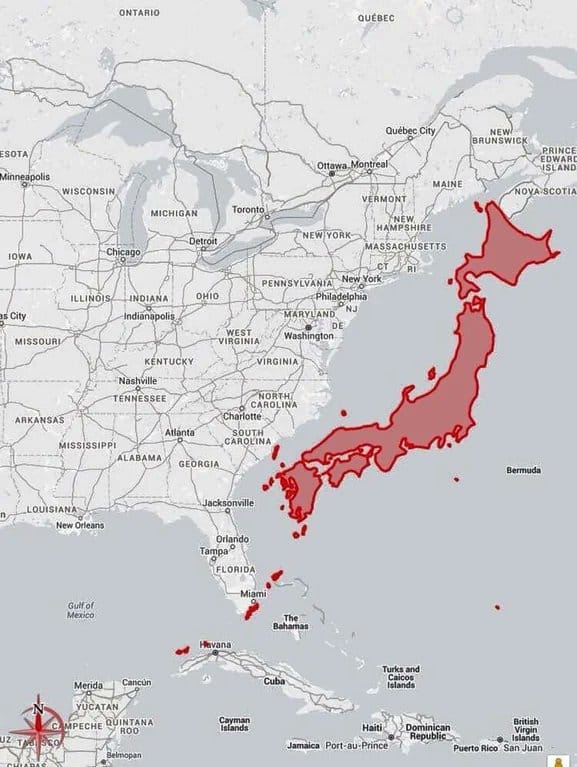 Japan vs US East Coast map
 2House Democrats oppose AI bailout
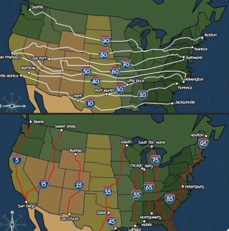 US Interstate highway numbering
 2Flávio Bolsonaro leaves Brazil
 Flavio Bolsonaro whereabouts unknown
 2Flávio Bolsonaro US travel allegation
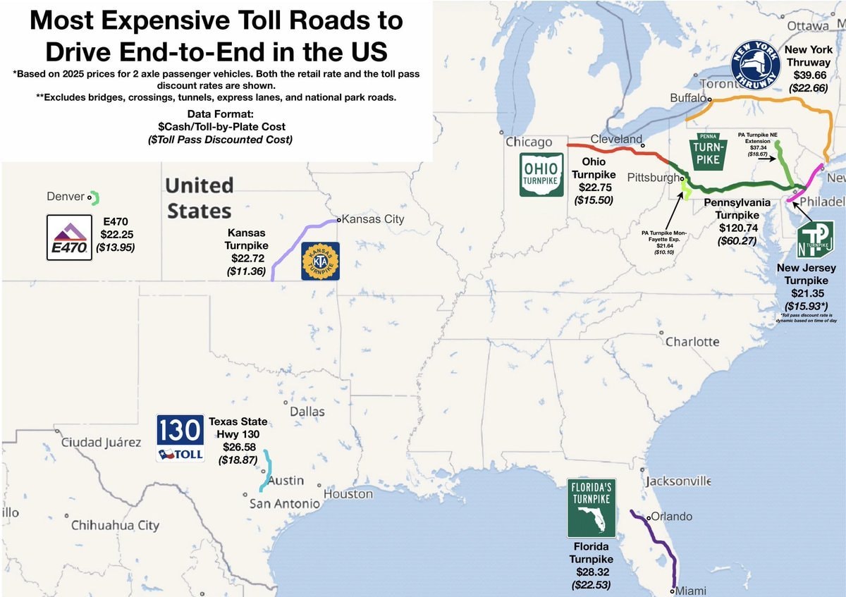 most expensive US toll roads map
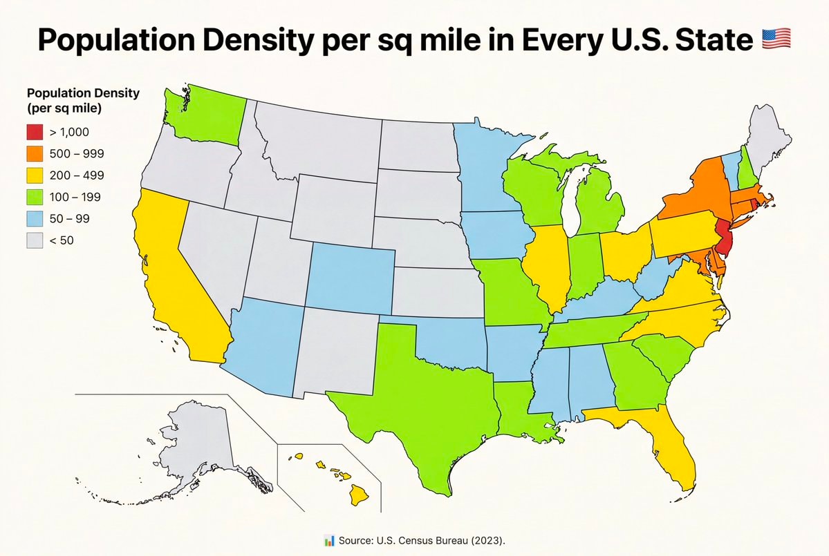 U.S. State population density per square mile
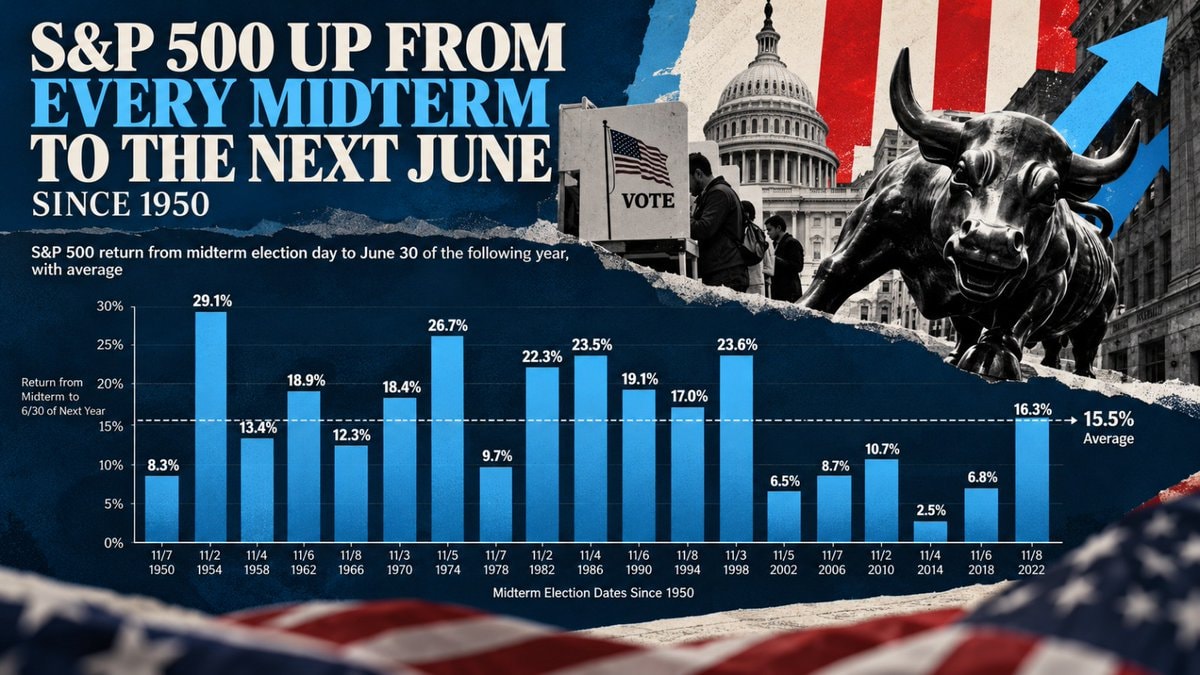 S&P 500 midterm election gains since 1950
 4NICU Halloween costumes US
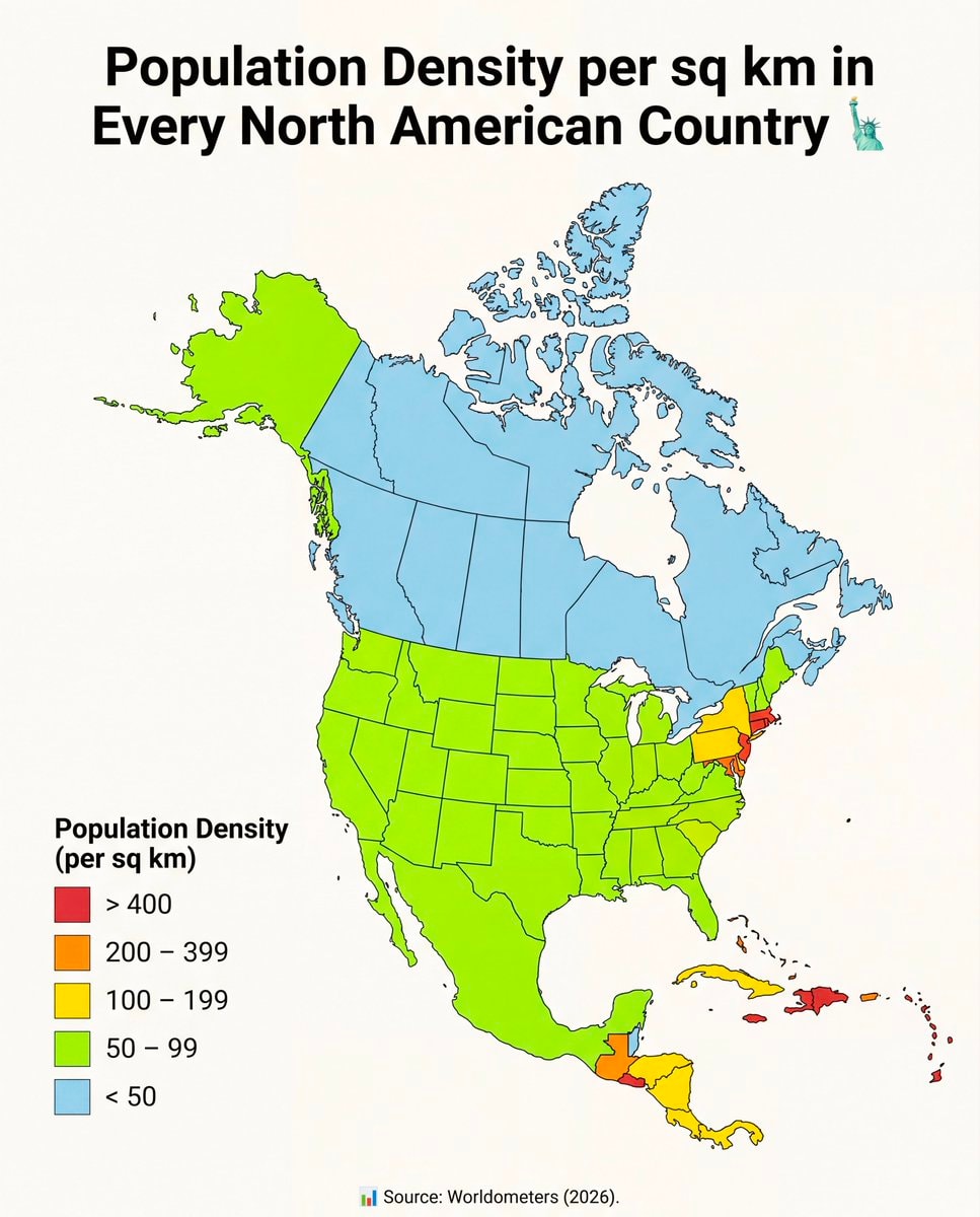 North America population density map
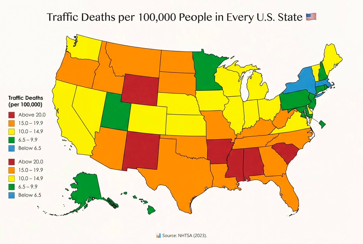 Traffic fatality rates by U.S. State
 US Iran strike tension
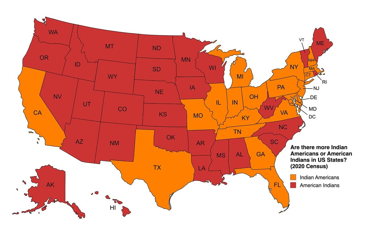 Indian Americans vs American Indians by US state
 AOC on a past gay US President
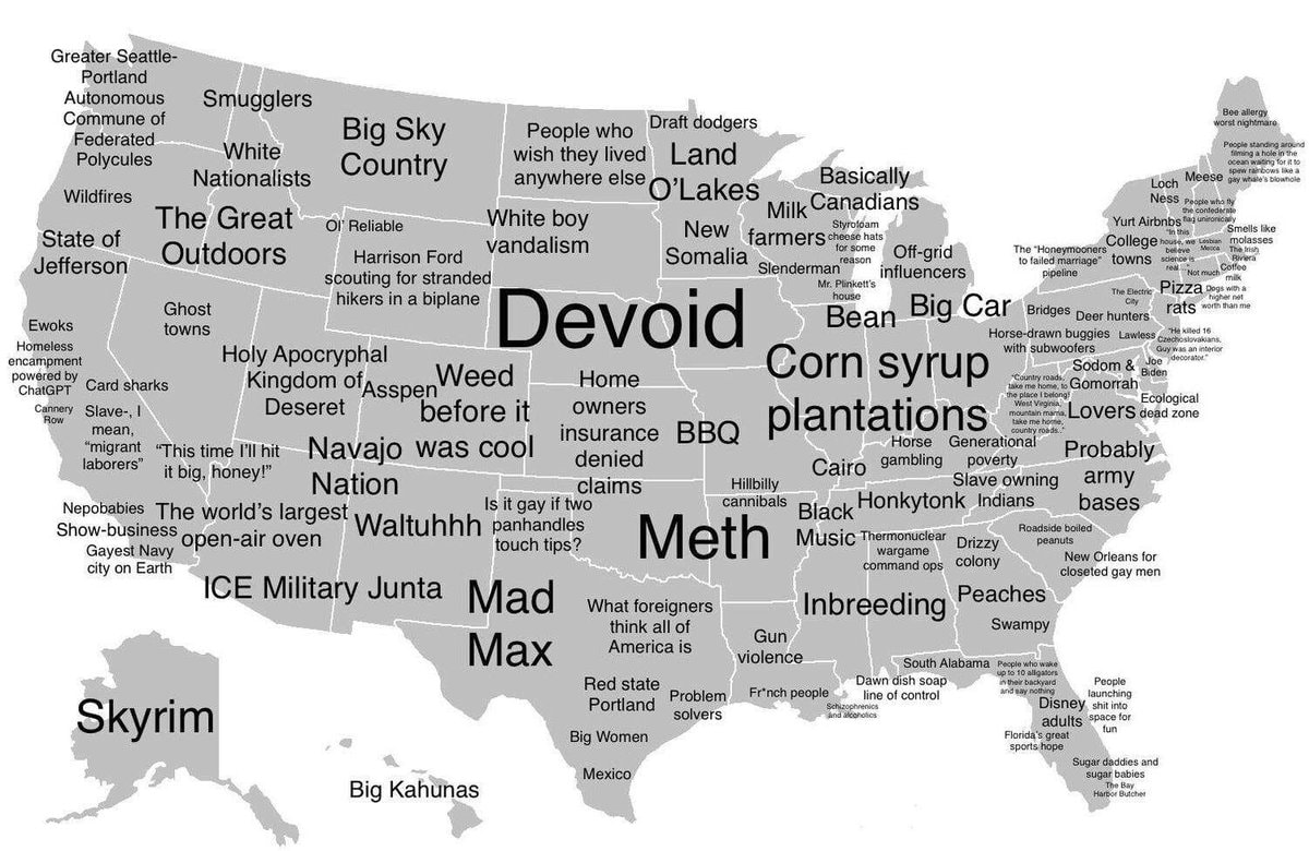 How Americans see America map
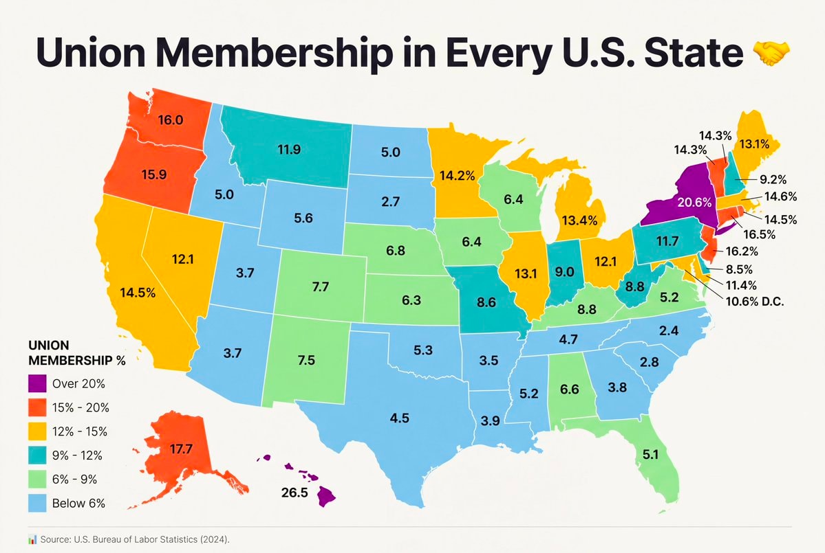 Union Membership by U.S. State
@savageupdatesActually every single U.S. state has households on public assistance or SNAP.
Originalbeitrag ansehenFoto von @savageupdates· Oct 29, 2026· United States
The image is a map of the United States showing the percentage of households receiving public assistance or SNAP in every state. The states are color-coded according to a legend that indicates percentage ranges from 5.0% - 7.9% to 16.0% - 20.0%. The mood is informative and data-driven. A small house icon is placed next to the title. The source is listed as U.S. Census Bureau, ACS (2024).
Noch keine Kommentare. Sei der Erste!
Natural gas price gap: US vs EuropeJapan vs US East Coast map2House Democrats oppose AI bailoutUS Interstate highway numbering2Flávio Bolsonaro leaves BrazilFlavio Bolsonaro whereabouts unknown2Flávio Bolsonaro US travel allegationmost expensive US toll roads mapU.S. State population density per square mileS&P 500 midterm election gains since 19504NICU Halloween costumes USNorth America population density mapTraffic fatality rates by U.S. StateUS Iran strike tensionIndian Americans vs American Indians by US stateAOC on a past gay US PresidentHow Americans see America mapUnion Membership by U.S. State
Noch keine Kommentare. Sei der Erste!